Co-Organized by
Organized by
 

BACKGROUND

US and India, the two largest democracies of the world, have a strong strategic partnership founded on shared values and a commitment to uphold international order, safeguard sovereignty and territorial integrity, and drive technology innovation and cooperation in technology domains of space and geospatial. Over the past decades, both countries have collaborated and provided deep convergence to enhance geospatial and space technology across each other borders, with almost five decades of space cooperation and almost two decades of high-technology trade and commerce.

Be it collaboration for ISRO’s Mars Orbiter Mission; the NASA-ISRO Synthetic Aperture Radar (NISAR) project; the deep, cooperative and long-data sharing arrangement between ISRO and NOAA for weather systems and applications; ISRO’s launch vehicle facilities to private US space companies; increasing trade (exports and imports) of geospatial solutions and services across border, rising collaboration between US Department of Defence and India’s Defense Space Agency, and the recently announced Basic Exchange and Cooperation Agreement for Geo-Spatial Cooperation (BECA) between the National Geospatial-Intelligence Agency of the US Department of Defense and the Ministry of Defence India – all are aimed at broadly advancing the relationship between the two countries and reinforcing their mutual interest in enhancing the penetration of geospatial technologies.

In the geospatial domain, US is a top trading partner for India. India exported approx., USD 1.21 bn in geospatial technology and enabled services, and imported USD 0.33 bn worth of geospatial technology to and from the US in 2021. Further, a total of 85000, i.e., 18% of the total number of employees of the Indian geospatial ecosystem, are engaged in export-related services, while more than 50,000 non-US residents of Indian origin are working in the geospatial-and enabled services field through the H-1B program. These numbers are bound to rise with strategic policy engagements, bilateral agreements, and increasing technology mandates.

Thus, there are many opportunities today in both countries to support long-term and long-withstanding partnerships that will nurture the spirit of geospatial entrepreneurship, create jobs, and provide for an efficient, profitable relationship between the geospatial businesses and governments of the two countries. The India-US Geospatial Business Summit – a business platform for ideation and engagement is the place to be on 2nd June 2022 to nurture the spirit of collaboration between two leading geospatial-ready countries. Join us!

AGENDA // June 02, 2022

13:00 - 14:00 Hrs.

Welcome Lunch

14:00 - 14:30 Hrs.

Opening Session

Sanjay Kumar
Moderator

Sanjay Kumar

CEO, Geospatial World

Dr Dhananjay Tiwary
Welcome Note

Dr Dhananjay Tiwary

Counsellor- Science & Technology, Embassy of India
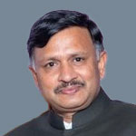
Dr. Nagendra Prasad
Guest Address

Dr. Nagendra Prasad

Consul General of India, San Francisco

Dr. Stephen Volz
Guest Address

Dr. Stephen Volz

Assistant Administrator - Satellite and Information Services, NOAA

14:30 - 15:15 Hrs.

Session I: Geospatial Infrastructure and Public Policies: Enabling Business Opportunities

Prof. Scott Pace
Moderator

Prof. Scott Pace

Director, Space Policy Institute, Washington DC

Sunil Kumar

Sunil Kumar

Joint Secretary, Dept. of Science and Technology, India

Topic: Enabling Indian Geospatial Policy: Business Opportunities in India

Mike Tischler

Mike Tischler

Director, National Geospatial Program, USGS

Topic: 3D Elevation Program: Opportunities for Data Processing and Management
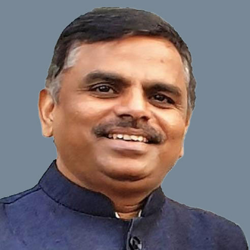
Dr. Ravi Kota

Dr. Ravi Kota

Minister - Economic, Embassy of India, Washington DC

Topic: Indian Economy and Ease of Doing Business

TIMOTHY J. CLAYTON

TIMOTHY J. CLAYTON

Director Acquisition Oversight, National Geospatial Intelligence Agency

Topic: BECA Agreement

Sanket Gupta

Sanket Gupta

Lead, Google Maps – International

Topic: Public Policies Fostering Innovation and Economic Development in the Geospatial Sector

15:15 - 16:00 Hrs.

Session II: India-US Geospatial Technology Collaboration: Opportunities for Industry

Keith Masback
Moderator

Keith Masback

Former Director, US Geospatial Intelligence Foundation

Ananya Narain

Ananya Narain

Director - Consulting, Geospatial World

Topic: An Overview of Geospatial Market in India and United States

Amit Ghosh

Amit Ghosh

Additional Secretary, Ministry of Road Transport and Highways, India

Topic: Geospatial and BIM Technology: Advancing Sustainable Transport Infrastructure through Gati Shakti Program

Harold Martin

Harold Martin

Director, National Coordination Office of Space based Positioning, Navigation and Timing, Department of Transportation, US

Ayushi Mishra

Ayushi Mishra

COO and Co-Founder, DronaMaps Pvt. Ltd.

Kari Bingen

Kari Bingen

Chief Strategy Officer, HawkEye 360, US

Dick Fleming

The Globe Building, St. Louis, USA

Topic: Incubating and Accelerating Geospatial Hub through PPP – Case Study of St. Louis

16:00 – 16:30 Hrs.

Coffee/Tea Break

16:30 -17:30 Hrs.

Session III: Technology Transfer and Make in India: Opportunities and Potentials

Kanwar Chadha
Moderator

Kanwar Chadha

Founder SiRF & Executive Chairman Argoid, Binatone & Hubble

Fernando R. Echavarria

Fernando R. Echavarria

Office of Space Affairs, Dept. of State

Ron Bisio

Ron Bisio

SVP, Trimble Inc

Dean Angelides

Dean Angelides

Corporate Director, International, Esri

Col Sunil S Fatehpur

Col Sunil S Fatehpur

Director, Survey of India

Dhananjay Tiwari

PV Rai

CEO, Pixel Softek

Abhilasha Purwar

Abhilasha Purwar

CEO, Blue Sky Analytics

17:30 - 18:00 Hrs.

Session IV: Panel Discussion/ Q&A / Way Forward

Sanjay Kumar
Moderator

Sanjay Kumar

CEO, Geospatial World

18:00 -19:00 Hrs.

Social Networking Reception

19:00 Hrs.

Gala Dinner being co-hosted with GeoBuiz Summit