//PROGRAM SPEAKERS
2 June, Thursday
Opening Session
View RecordingPLENARY SESSIONS
Plenary 1: Geospatial Industry Outlook And Business Directions
View RecordingPlenary 2: Geospatial Knowledge Infrastructure and Circular Economy
View RecordingNetworking Coffee Break
Plenary 3: Geo-convergence: Adding Spatial Dimension To Business Enterprises
View RecordingPlenary 4: Collaborative Opportunities for Space Infrastructure & Geospatial Value Chain
View RecordingLunch
DEEP DIVE SESSIONS
Collaborative Value of Space Infrastructure and Geospatial Knowledge Platforms
Networking Coffee Break
 Moderator
Vice President - Americas
Geospatial World
Coffee Break
 Moderator
Vice President - Americas
Geospatial World
3 June, Friday
Keynote Presentation
PLENARY SESSIONS
Plenary 5
View RecordingNetworking Coffee Break
Plenary 6: Geospatial Infrastructure: Empowering HD Mapping & Autonomous
View RecordingPlenary 7: GeoIntelligence and Evolving World Order
View RecordingPlenary 8: Investors: Connecting Value Chain of Space Infrastructure & Geospatial Services
View RecordingDeep Dive Sessions
Session 3: Architecture, Engineering & Infrastructure
 Keynote Address
Director of AEC Industry Solutions
ESRI

Director of the National Geospatial Program (NGP)
U.S. Geological Survey (USGS)

Managing Director
Schneider Digital

VP and GM
Satellogic North America

ICEYE provides dependable, timely access to high-resolution imagery by combining a microsatellite constellation with advanced processing tools to deliver insights at the speed of change. Day or night, in any weather, ICEYE empowers commercial and government partners to make informed, data-driven decisions that address national security challenges, improve infrastructure, protect the environment, and increase societal welfare.
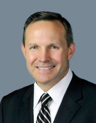
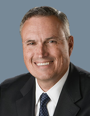
As President of ICEYE US, Eric Jensen is responsible for delivering spaceborne remote sensing capabilities to domestic partners, managing strategic relations, and driving overall company growth. He joined ICEYE in 2020, a year of significant scale for the firm, including external investments totaling $152 million to date along with the successful deployment of ICEYE’s seventh radar imaging satellite. The company is planning to deploy several additional satellites in 2021, including spacecraft manufactured and launched in the United States.
Prior to joining ICEYE US, Eric spent more than a decade at the Boeing Company, where he began his career as a design engineer. Eric was promoted to various engineering roles among NASA, Air Force and DARPA mission domains before moving into business development for Boeing’s Phantom Works division. Eric was subsequently recruited to lead the customer-facing team within Boeing’s Satellite Services group before becoming Vice President of Global Sales for Satellite Systems.
Originally from St. Louis, Eric attended Washington University in St. Louis where he obtained his bachelor’s degree in mechanical engineering. Upon graduating, he moved to the west coast and completed a master’s degree in mechanical engineering University of Southern California while working full time. Eric subsequently obtained a master’s degree in business administration from the University of California Los Angeles. Eric lives in Los Angeles with his wife and three daughters.

Mr. Grochol (Grow-shull) is a defense executive with a passion for building technology in the defense and intelligence space. He serves as the Chief Executive Officer for Iron EagleX, Inc., a fast-growing defense technology startup. Since 2019 IEX has been recognized as one of Tampa Bay’s Best Places to Work as well as Tampa Bay’s 50 Fastest Growing Companies. In 2018 he was selected as one of Tampa’s Top 40 Under 40 Professionals. Prior to IEX, Mr. Grochol was the Chief Strategy Officer for ISPA Technology, a defense firm with more than 15 years’ business experience supporting the Air Force, Navy, Combatant Commands, and Intelligence Community. His work contributed to ISPA Technology being recognized by Inc. Magazine as one of the 5,000 fastest growing companies in the US for 5 years in a row, from 2014 through 2018. Prior to becoming a business executive, Mr. Grochol served as an intelligence and aviation subject matter expert supporting the US Special Operations Command (USSOCOM). Mr. Grochol focused on technology application in real world environments. Mr. Grochol recently served as a member of the board of directors of the US Geospatial Intelligence Foundation where he sat on the finance committee and was responsible for assisting the foundation as it advances the tradecraft of GEOINT (mapping) professionals to include the foundation giving over $1M in scholarships in STEM focused areas to students from ages 12-35. He is an active member in the Open Geospatial Consortium as well as the American Geographical Society. Mr. Grochol is an active member in the non-profit Business Executives for National Security. Mr. Grochol has been an instructor for the Hillsborough Country Economic Development Center teaching veterans how to start and run their own small businesses. He is an Air Force Veteran with over 2,000 combat hours supporting US Special Operations Forces providing close air support from the AC-130 Gunship and various other non-standard aviation platforms.

Mr. Pomfret is a corporate partner at the Williams Mullen law firm where he represents government contractors and technology companies on a variety of matters, including mergers and acquisitions, investments, licensing, privacy and cyber security. He is co-chair of the firm’s Unmanned Systems practice group and the Data Protection and Cybersecurity practice group.
Mr. Pomfret is recognized as a leading authority on the legal and policy issues associated with geospatial information management. He has presented at Congressional hearings and United Nations’ committee meetings and is a member of the U.S. Department of Commerce’s Advisory Committee on Commercial Remote Sensing (ACCRES) and the UN-GGIM Working Group on Legal and Policy Frameworks for Geospatial Information Management. He is also an adjunct professor on Geospatial Law and Ethics at Johns Hopkins University and regularly conducts training and workshops across the globe on legal and policy issues associated with the collection, use, storage and distribution of geospatial information.
Mr. Pomfret began his career as a satellite imagery analyst with the National Photographic Interpretation Center (NPIC), a predecessor to NGA, where he worked on developing collection strategies and new collection systems. He is a graduate of Washington & Lee School of Law and Bates College.
Liam Weston is the Business Development Executive in-charge of ICCC (International, Commercial & Cross-cutting) space business development efforts for Raytheon Intelligence & Space’s (RIS) Space & C2 (SC2). He has been working in international business for Raytheon since April 2016 and commercial space remote sensing for nearly 30 years.
Prior to joining Raytheon, Liam served as an original team member of Ball Aerospace’s commercial business unit that built the highest resolution commercial imaging satellites in the United States, QuickBird and WorldView series, for DigitalGlobe which is now part of MAXAR. From the inception of Ball’s commercial business in the late 1990’s, Liam guided Ball Aerospace’s government policy initiatives for commercial satellites and international sales to market high-resolution commercial imaging satellites.
Liam also served as an advisor on international trade agreements for the Clinton, Bush and Obama Administrations having been appointed by successive Secretaries of Commerce to serve on the International Trade Advisory Committee for Aerospace (ITAC-1) from 2000 until 2015. Liam also served as a Board Member and twice Chairman of the Space Enterprise Council in Washington, D.C. from 2000 until 2015.
Liam served in the United States Army Reserve beginning in 1982 for 9 years mostly as an interrogator in the 418th Military Intelligence Detachment and later in Maryland. He also qualified for MOS’s in wheeled vehicle mechanic and another as the unit nuclear and biological chemical specialist.
Liam’s civilian career began in the mid 1980’s working as the East Coast Director of President Reagan’s lobby, Citizens for America and later in the 101st United States Congress as Press Secretary to a Member of the Foreign Affairs Committee and later running U.S. Government funded programs to assist rebel armies in Central America and Africa.
In 1989 Liam was appointed to head the USAID funded efforts to sustain the Yatama Nicaraguan rebels residing along the Nicaragua and Honduras border for the International Medical Corps. In 1991 he and his family moved to Angola, Africa where he administered the United Nations and WHO funded aid programs for the UNITA rebels occupying southeastern Angola including overseeing the largest crossborder vaccination campaign in the country coordinating between the Angolan Ministry of Health and UNITA rebels during various cease-fire agreements.
Liam was elected by a landslide in 1994 to the El Segundo, California City Council to a four-year term where he also served two years as the Mayor Pro-Tem of the city from 1994-1996. Liam’s unique business attraction program for El Segundo using “Minutes to LAX and Miles from LA” is still used by the city today which he left in 1998 with a budget surplus of $40 Million and over 10,000 new jobs by the end of his four-year term.
Liam graduated from Butte College in 1987 and has been married to his wife Carmen for 36 years. Together they have three grown sons and three grandchildren.

Clint Crosier leads the AWS Aerospace and Satellite Solutions business, responsible for providing commercial and government customers with tailored, secure, and cost-effective cloud solutions for building satellites, conducting space and launch operations, and reimagining space exploration. Before AWS, he spent 33 years in the US Air Force/US Space Force retiring as a Major General where he operated multiple satellite constellations, launched rockets putting satellites into orbit, and held key roles as a US Senate Staffer and in DOD Intelligence. He also served as the lead planner and architect of the stand-up of the US Space Force, the first new military service in 72 years.

Dr. Motoyuki Arai began his career working at a US-based consulting firm in Tokyo, Japan for 5 years to support more than 15 global companies to design new business and technology strategies, to formulate corporate governance and to build the internal controls necessary to run global companies.
He received his Ph.D. in Technology Management for Innovation from the University of Tokyo. During his time there, he focused his research on construction of energy systems to promote economic growth in developing countries. He then implemented his knowledge of business development to solve social issues in areas such as energy, water and sanitation, agriculture, and recycling in Saudi Arabia, Bangladesh, Laos, Cambodia, Kenya, Tanzania, and the devastated areas of Japan.

James is CTO, Chairman of the Board, and Founder of Orbital Insight – a later-stage startup funded by Sequoia Capital and Google Ventures (among others). Orbital Insight processes geospatial data at petabyte scale to help commercial and government customers understand what we are doing on and to the earth.
Previously he was SVP of Science and Engineering at the Climate Corporation through its $1B acquisition by Monsanto. Before his time at Climate he was CTO and Software Architect at Moon Express -- a company with the modest goal of putting the first commercial robot on the Moon. Previous to that he was engineering Director of Google Book Search where he was in charge of Google's project to scan, index, and make searchable the world's books.
James holds PhD and Master’s degrees in Computer Science from the University of Texas at Austin, and a BA in Math and Computer Science from Rice University.

Dr. Manfred Krischke is Founder and CEO of CloudEO an innovative cloud-based collaboration platform and marketplace for Geo-services. Besides holding other Board positions, he is Chairman of the Supervisory Board of Mynaric AG in Germany.
In 2011 he led the consortium to buy the assets of RapidEye (5 satellites constellation) out of the insolvency and was interim CEO for the restructured company.
He originally founded RapidEye in 1998 and was its CEO until 2004.
He was the Managing Director of Intermap GmbH and VP at Intermap Corp for six years. Manfred Krischke has been a Senior Advisor to Spacetec Capital Partners. Before that he consulted several companies and spent 8 month at Guildford consulting Surrey Satellite Technologies.
He started his career at Kayser-Threde GmbH, Munich (today OHB), where he was Business Development Manager for Navigation, Communication, Small Satellites and Manned Space Transportation.
He was awarded a PhD in Aerospace Engineering from the Technical University of Munich. In 1991 he received the Wernher-von-Braun Award of the Deutsche Aerospace (today Airbus) for the best visionary diploma thesis in Germany, which he wrote during his studies at the Harvard-Smithsonian Center for Astrophysics, Cambridge.

Michael Cottle is the Vice President of Global Sales and Customer Success at NextBillion.ai — a leading spatial data and AI platform that helps enterprises build, scale and manage their own mapping ecosystems.
He is also the Founder and Advisor to Code Foundation.org — a non-profit organization enabling computer programming and digital design skills for underserved students.
With a degree in Mathematics and Computer Science from University of Dallas and over 20 years in sales — 15 of which were across companies like Telenav, Mapbox, Bestmile, RideCell, Apple, and deCarta — Michael is a proven veteran of the mapping space who isn’t afraid to dive into technicalities. He dedicated a decade of his career to deCarta as the Vice President of Worldwide Sales, until they were acquired by Uber Technologies in 2015.

Preetha Pulusani is founder/CEO of FinTech company, DeepTarget, Inc serving hundreds of financial institutions with its patent pending marketing and engagement Digital Experience Platform fueled by AI, Big Data and BI. Previously, she was President, Rolta – International Operations and prior to that, Ms. Pulusani culminated a career of 25+ years at Intergraph, as President, Security, Government & Infrastructure with global revenues of $400+ million; she began her career there as entry-level programmer in Mapping/GIS. Preetha holds an M.S. in Computer Science from the University of Alabama at Huntsville, has served on various industry boards and in 2006 was recognized as the Alabama IT Association’s Top IT Executive.

Joe Astroth CEO-USA of Cyclomedia has over 25 years of experience in executive management in the geospatial industry. Joe is also recognized as a leader in the world of education, with 10 years of experience as both professor and chief education officer for a Fortune 1000 company. He currently serves on five Board of Directors and Executive Advisory boards.
Joe completed his doctoral work at the University of Chicago where he was awarded the Fulbright Hays Doctoral Dissertation Research Abroad Fellowship and the Mellon Foundation Dissertation Award.

Patrick Cozzi is the CEO of Cesium, where he works at the intersection of technology and business to lead the open platform for 3D geospatial and bring 3D geospatial solutions to markets across earthworks, defense, and infrastructure. He is a longtime advocate of open source and open standards to enable community collaboration.
Patrick started Cesium and 3D Tiles, an OGC Community Standard for massive heterogeneous 3D geospatial data. He is the co-creator of glTF, the open-standard 3D model format, and served as the former chair of the Khronos 3D Formats Working Group. Patrick has taught hundreds of computer science and graphics students at the University of Pennsylvania, and has authored or contributed to over ten books on mapping, computer graphics, and games.

Mr. Haight has over 20 years’ experience spanning the fields of information technology, engineering, wireless technology and private equity. Prior to Critigen, Jeff enjoyed a distinguished career at CH2M Hill where he held many leadership positions including Senior Vice President and Northwest Regional Manager; Global Director, Management Consulting; and Western Regional Director of Enterprise Management Solutions. In addition to his accomplishments in the consulting industry, he is the co-founder of two network security companies and chair of several non-profit boards.

Peter is CEO and Founder of Voxelmaps Inc, a leading GIS mapping company building 4D Maps for Machines. He has been in the mapping industry for 17 years and has led large scale international mapping projects for some of the biggest technology companies in the world. Previously he was CEO and founder of Navmii a navigation and mapping company with over 30million users that mapped 180 countries. Peter is a technology entrepreneur with 2 successful exits.

Alain De Taeye is a member of TomTom’s Management Board. Lauded as the ‘man who rocked the mapping world’, Alain has dedicated his career to the digitization of maps and routing.
Alain founded Informatics & Management Consultants (I&M), which, in 1989, was integrated into the Dutch Tele Atlas group which he eventually headed.
At Tele Atlas, Alain focused the company on the digitalization and commercialization of geospatial content and successfully introduced the company to the Frankfurt and Amsterdam stock exchanges.
In 2008, TomTom acquired Tele Atlas and Alain joined the TomTom Management Board. De Taeye's vision and leadership at TomTom have brought consistency in the company’s geospatial content strategy, offering new dimensions and innovations including the introduction of TomTom’s specialized maps and streaming technologies for automated driving.

Matt O’Connell is an Operating Partner with DCVC (Data Collective Venture Capital) (Palo Alto). He sits on the Boards of two portfolio companies, Capella and Fortem. Prior to joining DCVC, Matt was a Managing Partner at Seraphim, a London based venture capital firm focused exclusively on space. From October 2015 to July 2016, Mr. O’Connell was CEO of OneWeb.
Matt founded GeoEye (NASDAQ: GEOY), a leading global provider of satellite and aerial imagery and digital mapping information, in 2003. GeoEye grew from 60 employees producing $9 million of revenue per year, with an equity value of zero and enterprise value of $33 million, to 760 employees producing $360 million, with an enterprise value $1.3 billion and an equity value of approximately $850 million. In January 2013, he concluded its sale to DigitalGlobe.

Will Cadell is the founder and CEO of Sparkgeo, a geospatial partner for some of the biggest brands in technology. Since starting Sparkgeo, he has been helping startups, large enterprises, and non-profits across North America make the most of location and geospatial technology. With an academic background in Engineering and Remote Sensing Will has worked in the government science, municipal, resources and technology sectors turning data into value. At Sparkgeo, Will leads a distributed team of geospatial experts, solving interesting problems at web scale and providing geospatial advice to unicorn Startups and Fortune 500 companies alike.
Will is the Chair of Innovation Central Society, a non-profit focused on supporting technology entrepreneurs in Northern British Columbia by providing business programming and co-working space.

Mr. Phillip C. Chudoba serves as the Associate Director for Capabilities, National Geospatial-Intelligence Agency. In this capacity, he is responsible for defining the strategic direction of the agency and implementing that strategy. He provides oversight, synchronization, guidance, and development of NGA, National System for Geospatial Intelligence, and Allied System for Geospatial Intelligence strategic direction, future resource programming, capabilities planning, and oversees acquisition, innovation, research, and the adoption of new technologies supporting GEOINT requirements.
In his prior position, Mr. Chudoba was Director of the GEOINT Enterprise Directorate. Previously, he served as the Assistant Director of Intelligence, Headquarters U.S. Marine Corps, from 2010 to 2018.
Mr. Chudoba served as a U.S. Marine from 1980 to 2010, first as a Marine Infantryman before being commissioned, and then as an Intelligence Officer until his retirement as a Colonel.

As CEO of Foursquare, Gary is responsible for driving the company's mission and vision as the world's most trusted and independent location technology platform. Prior to joining as CEO in 2021 Gary served as a Foursquare board member, helping to guide the mergers and acquisitions of Placed and Factual.
Prior to joining Foursquare, Gary was a Managing Director at Raine focused on advisory assignments and principal investments in the consumer internet, digital media and technology sectors. Gary also helped the founding team establish Buckthorn Partners LLP, a London based private equity firm specializing in growth capital investments and acquisitions in the oil field service sector. Before joining Buckthorn, Gary spent several years in London and New York at UBS, Lazard and Credit Suisse advising Financial Sponsors and their portfolio companies on a range of M&A, capital market and strategic advisory assignments.
Gary received a B.A. from Seattle University in Finance and Economics and an M.B.A. from Columbia Business School.

Shan He is senior director of engineering at Foursquare and Co-Founder of Unfolded. She is a coder, a designer, and a data artist who has built her career in geospatial analytics and visualization. Before founding Unfolded, Shan was the first member of Uber's data visualization team. At Uber, she created the advanced geospatial visualization tool kepler.gl which won the 2018 Kantar Information is Beautiful Award.

As Smart City Director for the City of Philadelphia, Emily is responsible for managing and leading the implementation of the SmartCityPHL Roadmap that provides guidance on how smart and emerging technology solutions can improve the quality of life for residents, businesses and visitors while improving the delivery of City services.
Throughout her career, Emily has worked to help cities position themselves as globally competitive by utilizing a systems approach to develop strategies, projects and programs that exist within the intersection of sustainability, technology, and economic development. Most recently, Emily was Deputy Director with Envision Charlotte where she was responsible for leading the development of the Circular Charlotte strategy, which made Charlotte the first city in the US to have a citywide circular economy strategy, in addition to other local programming that created a smarter, more sustainable Charlotte.
She has held a variety of positions in Europe and North America, including urban planning positions with both the District of Columbia and the city of Cleveland planning offices. Emily was a recipient of the prestigious Alexander von Humboldt German Chancellor/ Bundeskanzler Fellowship, which funded a year of research focused on German approaches to the implementation of sustainability policy and climate change adaptation in brownfield development. Emily holds a Bachelors of Science in Landscape Architecture from Arizona State University. She is a member of the Emerging Leaders in Energy and Environmental Policy (ELEEP) Network.

Matt Tirman has more than seventeen years’ experience growing global technology and service businesses across public sector and commercial markets with a focus on defense and aerospace. He joins Satellogic from Descartes Labs, a leading provider of geospatial and multi-sensor analytics, where he was the Head of Government and was responsible for revenue growth and customer delivery across defense and intelligence clients.
Previously, Matt served as interim-Chief Revenue Officer at a leading InsureTech startup and was Chief Commercial Officer at PlanetRisk where he was responsible for delivering enterprise geospatial risk analytics, customized big data solutions, and projects to Global 1000 customers spanning retail, manufacturing and technology. Matt played an integral role in the sale of the company's product business to Everbridge, a global software company focused on the mass notification and risk market.
From 2014-2018 Matt founded and operated the consulting and advisory firm, Access Global. Clients included family offices looking to invest in East Africa, global energy firms, and a US based cybersecurity company requiring an interim CEO, and a Canadian telecommunications leader keen to break into the SE Asian market. In 2009 Mr. Tirman left his role at Accenture to become the first employee at Strategic Social, a technology and services firm operating in emerging and frontier markets across the Middle East and North Africa. He was responsible for revenue generation, establishing foreign business ventures, operations, and the strategic direction of the firm and was integral to the acquisition of the company. Matt and his team grew Strategic Social to more than $40M in annual revenue before it was sold to Constellis in 2014. He has served as an analyst for the US Department of Defense on cooperative Research and Development and as a speechwriter for senior military leadership in Washington D.C. and Baghdad, Iraq.
Matt holds a MA in Defense and Security from Lancaster University and a BS in Political Science from East Carolina University.

Alec is a productivity expert with over 15 years of global management consulting experience. Alec holds an MBA degree with a specialization in Macro Economics and Strategic Management. He has a keen interest in visualization and spatial technologies. Alec is an experienced entrepreneur with three previous successful startups and the founder of vGIS.
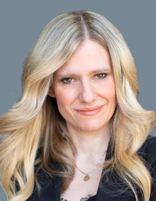
Sonya Shorey, Vice President of Strategy, Marketing and Communications for Invest Ottawa, Bayview Yards and Area X.O, is a strategy executive and management consultant with more than 20 years of leadership experience with private and public organizations. With expertise in regional, national, and global technology, entrepreneurial, economic development, and innovation-based organizations, she specializes in corporate and communications strategy development and execution. This includes investment strategies that secure new cash and in-kind contributions from public and private sources. Since 2005, Sonya has led, strategized, authored and/or made a significant contribution to successful multi-year funding proposals and initiatives valued at more than $193 million from municipal, provincial, federal, and international governments.
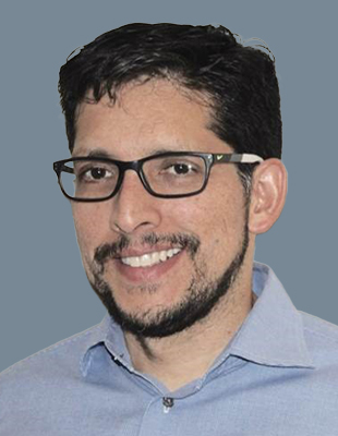
Dr. Bermúdez is the CEO of GeoSolutions USA, one of the world’s leaders in supporting commercial, open source geospatial software. Before joining GeoSolutions, Dr. Bermudez worked for 10 years at the Open Geospatial Consortium, advancing open standards used worldwide, leading the Innovation Program. He has innovated on the design and implementation of environmental information systems, including hurricane prediction and monitoring, as well as of legal information systems. Dr. Bermudez, holds a PhD on environmental Informatics from Drexel University and is an adjunct faculty at the GIS Masters program at UMBC.

Dr. Shawana P. Johnson, GISP, is a global commercial satellite sensor subject matter providing Geospatial Business Intelligence Expertise™ helping government clients understand the vast range from commercial Spaceborne, Airborne and Terrestrial based Sensors for their Interoperability with the Government and Global Business community focused on AI/ML usage of sensors for Communications, National Security, Energy Resources, Agriculture and Water Sustainability; and Logistics and Supply Chain. Her data base consists of over 1million current geospatial contacts globally which provides real user input for client sensor access and application success. Her expertise encompasses interacting with global ground stations, launch providers, satellite developers, Defense contracting and acquisition organizations, National Labs, and hundreds of small and mid-sized geospatial value added organizations. Dr. Johnson was awarded a certificate of completion for the Senior Managers in Government Program, 8/2019, John F. Kennedy School of Government at Harvard University, Executive Education and received her Doctorate Degree in Management from Case Western Reserve University, The Weatherhead School of Management; Cleveland, Ohio in 1998 focused on Economics and Technology Transfer and is currently certified by The GIS Certification Institute, Park Ridge, Illinois – as a Geographic Business Information Systems Professional (GISP), 2007, 2012, 2018. Dr. Johnson is a Global Subject Matter Expert in the Geospatial Industry, and advises the Commercial as well as Intelligence Community sectors. She is an advocate for the Geospatial Industry and is a well-known speaker and has authored hundreds of geospatial industry specific articles, white papers and book chapters. She serves on multiple industry boards, government committees, and associations which serve to advance the science of remote sensing and geospatial technology.

Brian Manning is co-founder and CEO of Xona Space Systems, a company focused on enabling safer operation of modern devices by providing high-performance satellite navigation and timing services from small satellites in Low-Earth Orbit. He holds an MBA from the London Business School and an MSc in Aeronautics and Astronautics from Stanford University. Brian is a former SpaceX engineer coming from an entrepreneurial background of small family businesses, and co-founded Xona in 2019 with an extraordinary team of GNSS and satellite experts who were classmates at Stanford University.

Philip Morris has held several positions within the GNSS Industry for the past 25 years, including Applications Engineer, Test Group Manager, Product Manager, Global Commercial Sales Manager as well as other positions within Operations. He is currently the Sales Manager for NovAtel’s Aerospace and Defense Team, which falls under Hexagon’s Autonomy and Positioning division. He has achieved his Associates and Bachelors degrees in Engineering and most recently an MBA with a focus on Global Business Strategy from Arizona State University’s W. P. Carey School of Business.

Mike is the head of SafeGraph's public sector business overseeing the strategy and sales into government customers. Previously he led Partnerships and Government Affairs for Orbital Insight, was a former Marine, and has spent his whole career in the geospatial and intelligence industry. He has a B.S. in Finance from Lehigh University and an M.B.A. from Georgetown University. Mike can be found on a beach or a mountain depending on the time of year.

John Copple is the Owner and Chief Executive Officer of The Sanborn Map Company, Inc. (Sanborn). He also is a board member of two other technology companies. His career spans satellite, aerial, drone, and ground remote sensing technologies. Sanborn is the oldest geospatial company in the United States and continues to develop new applications and technology of geospatial data. Sanborn operates globally with operating locations in the United States and international offices. John is a strong believer in the value of remote sensing technologies and geographic information systems and has traveled extensively developing business both domestically and internationally. Previously he served as Chairman and Chief Executive Officer of Space Imaging, Inc., one of the first commercial satellite imaging companies. Prior to Space Imaging, he had a distinguished career in a variety of roles at E-Systems, a $3 billion public technology systems company where he became a Corporate Vice President. E-Systems developed technology for the Defense and Intelligence community and was acquire by Raytheon in 1995. Mr. Copple has a master’s degree from The University of Texas in Austin.

Over a 20-year career in cybersecurity and information technology, Ajay has seen companies create true competitive advantage from successful management of security and technology initiatives. At the same time, healthcare is burdened with outdated technology infrastructure and inefficiencies - which are often measured in human lives. So Ajay decided to take his understanding of technology and implementation to disrupt and innovate healthcare.
In launching HSR.health, Ajay leverages the best of tech to transform American healthcare into a system that innovates healthcare delivery achieving improved quality, lower costs, and health equity. Under Ajay's leadership, HSR.health pivoted to support COVID response in the US and globally. And through its lessons learned has developed insights into how health risks impact broader markets. The company is developing a digital Pandemic Early Warning and Response Platform to identify and mitigate impact of future pandemics.
In addition to his work at HSR.health, Ajay Chairs the Health Domain Working Group for the Open Geospatial Consortium, the global standards setting body for all things Geo; serves as the Secretary of the Board of Directors of Holy Cross Health, a multi-hospital social safety net health system in Montgomery County, MD; and is on the Board of Governors for his alma mater, the fearless University of Maryland, College Park.
If he isn't using the HSR.health geospatial platform to map disease rates against social factors to identify solutions to population health challenges, such as the opioid epidemic or maternal mortality, you can find him at sporting events (#LetsGoNats, #ALLCAPS) or behind the mic bursting eardrums while belting out his favorite pop music tunes from U2, Sting, George Michael, or Imagine Dragons.

Hamed Alemohammad is the Chief Data Scientist and Executive Director at Radiant Earth Foundation, leading the development of Radiant MLHub- the open repository for geospatial training data and models. He has extensive expertise in machine learning and remote sensing as well as building and managing technical teams. Hamed serves on the Technical Advisory Boards of Lacuna Fund and Enabling Crop Analytics At Scale (a Bill and Melinda Gates Foundation initiative). He also serves on the AGU’s technical committee on remote sensing. Prior to joining Radiant Earth, he was a Research Scientist at Columbia University. Hamed received his PhD from MIT in 2014.
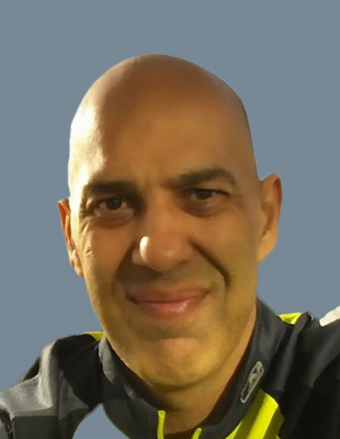
Rafay Khan is the CEO of Moove.Ai, he has over twenty years’ experience in Location Based Services, Connected Car and Autonomous with deep industry experience in Automotive, Smart Phone, Technology Platforms and Enterprise.
Passionate on leveraging “machine learning” and “connected vehicle data” to get to safer and greener mobility; keen interest in Design Thinking; Innovation across Transport Ai.
Prior to Moove AI, spent 4 years as Chief Revenue Officer at INRIX. Before INRIX, as SVP at DigitalGlobe (MAXR) drove double digit growth for successful company IPO. Earlier years spent as part of the executive team at NAVTEQ (HERE Technologies) with extensive experience in developing global footprint in Asia, Middle East, South America and Eastern Europe.
Prior to getting hooked on “location-based services” Rafay worked at Chrysler’s Crash Simulation Labs building finite element models on Cray Supercomputers.
Rafay has a M.Sc. in from Stanford University and MBA from The University of Chicago Booth School of Business.

Rainer Horn is the Founder and Managing Partner of SpaceTec Partners. He has long experience in (new)space, space applications and geospatial industry as consultant for institutions and the commercial players. He is a member of several boards in space programmes in Europe and Asia. He is also an active business angel investor.
Prior to embarking on his successful entrepreneurial journey, he advised the earthly telecommunications and mobility industry, and served as European Operations Director of Booz Allen Hamilton. Rainer holds a dual business degree from ESB in Reutlingen & London and attained an MBA from INSEAD.
SpaceTec Partners is a unique boutique consultancy as its team combines years of consulting craftsmanship with in-depth expertise of the space industry. SpaceTec Partners assists its clients with strategy, market development and innovation advisory. Clients include institutions, industry, startups and financial investors globally.

Steve “Bucky” Butow is the Director of the Space Portfolio at the Defense Innovation Unit (DIU). He joined the team in 2015 as an early plank owner when DIU was known as the Defense Innovation Unit Experimental (DIUx) and helped establish the organization’s operating locations in Silicon Valley, Boston, Massachusetts, and Austin, Texas.
Brig. Gen. Butow also serves as Commander, California Air National Guard. In this role, he is the primary advisor to The Adjutant General on all programs, strategic planning, and operations affecting the California Air National Guard. He is responsible for the mission readiness and operational effectiveness across a broad spectrum of programs and activities involving five wings and over 4900 military and civilian personnel. to joining DIU, Butow was the Vice Chief of the Joint Staff, California Military Department with responsibilities including cybersecurity, incident awareness and innovation. He is a former Commander of the 129th Rescue Wing at Moffett Federal Airfield, CA, where his responsibilities included organizing, training, equipping, and maintaining 970 combat-ready forces and $1 Billion dollars of MC-130P aircraft, HH-60G helicopters and special mission equipment supporting the U.S. Air Force’s combat rescue and personnel recovery missions. He has additionally served as the Deputy Director of the Joint Search and Rescue Center for U.S. Central Command in 2005, and as Chief of Personnel Recovery for U.S. Air Forces Central in 2007 supporting Operations IRAQI and ENDURING FREEDOM. He has more than 3,500 flying hours in T-37, T-38, C-130, HC-130 and MC-130P aircraft. In his reserve capacity, Butow is a Brigadier General serving part time as a Special Assistant to the Director, Air National Guard in a federal (Title 10) status.
As a researcher with the Search for Extraterrestrial Intelligence (SETI) Institute, Butow worked on instrument concepts for Mars surface soil analysis at NASA Ames Research Center in Mountain View, CA. He later served as co-principal investigator for a series of airborne science missions for which he was recognized for outstanding achievement and contributions to the Space Science Division in 1999 and received an Ames Honor Award as a member of an Astrobiology Mission Project Team in 2000.
Butow graduated from San Jose State University with a B.A. in Physics & Astronomy and earned a M.S. in Management with specialization in Air and Space Strategic Studies from the University of Maryland. He has also completed executive courses at Harvard’s John F. Kennedy School of Government, and was a member of the National Leadership Preparedness Initiative (NPLI) Cohort 16. Butow is a lifetime member of the Honor Society of Phi Kappa Phi for academic achievement.

Kendrick O. Faison is the President/CEO of SpatialGIS. He has served in many capacities managing local, state, and federal GIS programs. He started his GIS career at the National Geospatial-Intelligence Agency (NGA) as an Imagery Analyst. He later moved over to the National Security Agency (NSA) supporting Booz Allen Hamilton. In 2007, Mr. Faison managed the GIS Office for the City of Laurel where he stood as the first enterprise GIS system for the city. He would get his introduction into emergency management working for the Baltimore City Mayor’s Office for Emergency Management as the GIS/IT manager.
Mr. Faison would then go on to work for Esi Acquisitions, Inc, Creators of “WebEOC” and serve as Federal Regional Manager. Before starting SpatialGIS, Kendrick served as the National Geospatial-Intelligence Lead for the Federal Emergency Management Agency (FEMA) where he served as the GIS lead during Hurricane Sandy.
Mr. Faison is an Assistant Adjunct Professor at the University of Maryland Global Campus, where he teaches in the Department of Homeland Security. He is also an active member of the 100 Black Men of America and Phi Beta Sigma Fraternity Inc. He serves on the Anne Arundel County (MD) Planning Advisory Board. He is currently the National Chairman of SigmaPAC1914. Inc.
Mr. Faison holds two Bachelor’s Degrees: Bachelors of Arts in History and Bachelors of Arts in Geography from Fayetteville State University, Fayetteville, North Carolina and a Masters of Geosciences from Murray State University, Murray Kentucky. Mr. Faison is the father of three wonderful children Maliyah, Octavis and Kaylee

Samira Khan is currently a Director at Microsoft, working on Citizenship Market Development, AI and Sustainability within the Chief Digital Office. Previously, she was working at the intersection of social innovation / impact + tech at Salesforce.org. Samira has worked across corporations, governments, and the social sector for over thirteen years on innovative solutions to solving some of society’s greatest challenges. She is especially interested in business model innovations for good. Her work spans the Americas, the Middle East, and Asia. She is a former strategy / management consultant; and while at A.T. Kearney in Southeast Asia, she played a lead role in starting and building its social impact organization. She is also passionate about topics related to gender and youth empowerment toward the Sustainable Development Goals (SDGs). She can be found @samiraakhan on Twitter / LinkedIn.

Jason Wortham, Vice President of Solutions Consulting at Premise Data, is an experienced software solutions specialist having held roles in implementation, training, solutions selling and product management in the technology industry spanning nearly two decades. Mr. Wortham now serves as a strategic resource to Premise Data’s sales, product and growth teams articulating Premise's technology and product positioning to customers, prospects and partners through targeted full-solution product demonstrations.Mr. Wortham has worked for and alongside local, state and federal government entities throughout his career including managing multimillion dollar projects in the Middle East, Canada and across the US. Mr. Wortham has also overseen product, engineering and quality assurance teams both large and small in the design, development and publication of large scale enterprise software applications used by tens of thousands of government employees and millions of citizen customers around the world. Geospatial intelligence has played a critical role in Mr. Wortham's career including leveraging all facets of Esri's GIS mapping suite of products as well as Mapbox, Google and Apple mapping platforms.

Ryan McKinney, Vice President and General Manager of Satellogic North America
Ryan McKinney is VP and General Manager of Satellogic North America. Prior to this, he was Head of Strategic Initiatives at Descartes Labs. Descartes Labs is a 2014 spin-off from Los Alamos National Labs focused on provisioning multiple global remote sensing modes of data on an automated planetary scale platform providing multi-modal applications using AI/ML models and algorithms for rapidly advanced analytics.
Ryan possesses over 20 years of experience in sales and business development, including a diverse background with start-up, turnaround, and high-growth environments. He has successfully driven growth through direct-to-consumer sales and partnership building with OEMs, VARs, Global Remote Sensing Producers (space, air, and terrestrial,) and system integrators. His multi-industry experience includes private and public sectors. Prior to Descartes Labs, he was with Cyence Inc. (acquired by Guidewire Software) focused on cyber risk modeling. Prior to Cyence, Ryan worked with other enterprise IT hardware and software companies supporting both US Government and large enterprise business.

With his roots in the geospatial industry, Andrew joined the Sparkgeo team in 2022 as the Vice President of Business Development.
Prior to joining the Sparkgeo, Andrew held the positions Director of Programs and Chair of the Project Advisory Committee for TECTERRA Inc., a non-profit focused on investment in Canadian geospatial startups and SMEs. Prior to that Andrew managed the Client Services Department for Itres Inc., a remote sensing technology firm that specialises in the development and deployment of hyperspectral and thermal technologies.
Andrew holds a Bachelor's of Science in Geography (Remote Sensing) from Memorial University of Newfoundland.

James Van Rens is the Senior Vice Preisdent of RIEGL USA, the North American distributor of RIEGL Laser Measurement Systems, which is recognized as the performance leader in the mobile mapping, civil infrastructure, airborne scanning, unmanned, hydrographic, bathymetric, mining and terrestrial based industries.
Mr. Van Rens holds a combination BA/BS degree from Marquette University and has over thirty years of experience in remote sensing, 3D mapping, and LiDAR technology.
Mr. Van Rens is an industry leader in 3D mapping techniques and their applications and lectures extensively to professional and lay audiences alike.

Ms. Sandra Auchter serves as the Director, NGA-Denver (NGA-D) at the Aerospace Data Facility – Colorado (ADF-C). She leads a diverse team of over 500 personnel. As NGA’s only senior executive at the ADF-C, she represents the interests of NGA-D as a member of the ADF-C’s Denver Leadership Team (DLT), which includes the ADF-C site commander, NRO’s senior representative, the Director, NSA Colorado (NSAC) and their deputy directors. As a DLT member, she concentrates on a range of issues that focus on exploring and improving how the three agencies integrate and collaborate across mission areas and across each agency’s distinct personnel skill-sets.
Ms. Auchter received her Bachelors of Science Degree in Regional Studies, Africa, from the School of Foreign Service, Georgetown University and is an alumnus of the National Defense Intelligence College/National Intelligence University.
Ms. Auchter resides in Denver, CO.

Ben Riggle is the VP of Sales at Veraset, the leader in population movement data.
Ben has led teams that help organizations across the world drive growth through innovative uses of technology and data. Most recently, he led the growth of Talkwalker’s US go to market team, attaining leadership status in Social and Consumer Intelligence by working with organizations to better connect with their consumers.
When away from “the office,” Ben can sometimes be found exploring the metaverse and reading.

Justin Puent is the Full Autonomy Product Manager for Hexagon’s Autonomy & Positioning division based out of Morton, IL. At Hexagon, his focus is centered around Hexagon’s commitment to implement and pioneer end-to-end autonomy and positioning solutions used to accelerate an autonomous future. Justin works closely with his customers and business partners to identify and sustainably solve issues in the on-road and off-road autonomy markets. He has been strategically involved with notable projects such as ADS for Rural America, the Indy Autonomous Challenge, and the most recent, Mineral Resources’ Autonomous Road Train project in the mining regions of Western Australia

Sean Wiid is the Chief Executive Officer of UP42. He has spent his whole career focused on geospatial technology and building digital mapping businesses. Prior to UP42, he was SVP of Platform and Content at Navico, where he ran the global map production operation and built the cloud platform team. At HERE Technologies and Nokia, Sean was responsible for strategy, business planning, and operations for the B2B business - helping to build and commercialize the HERE Location Platform. In previous roles at GDC (now part of Pitney Bowes) and Spatial Dimension (now part of Trimble), Sean worked as a software architect and lead developer building geospatial solutions for land administration, mining, and government. Seans strong technical foundation is underpinned by BSc and MSc degrees in Geomatics and Engineering, complemented with an MBA from the European School of Management and Technology (ESMT) in Berlin.

Ryan is a 20-year GIS and Remote Sensing industry professional previously supporting remote sensing acquisition and mapping projects from fixed wing, satellite, and drone-based platforms as well as GIS software applications for all levels of government and commercial industry clients. Ryan helps lead GeoSolutions' participation in OGC projects and holds a BA in Geography and Regional Development from University of Washington and is currently a GEOINT graduate student at Penn State University.

Mr. Timothy Tim J. Clayton was appointed as the Deputy Component Acquisition Executive in February 2018. He is tasked with planning and leading acquisition workforce development and certification in NGA in addition to developing acquisition policy and supporting oversight of the agencys acquisitions, with specific emphasis on programs categorized by the DNI and DoD as Major System Acquisitions or Special Interest Acquisitions. He is a member of the DoD Acquisition Corps and certified in Program Management.
Prior to this assignment, Mr. Clayton served as a Senior Inspector, Office of the Inspector General, NGA. As Senior Inspector he led annual IG planning activities, developed and executed inspections on a broad range of topical issues. Notably, Mr. Clayton led inspections and produced reports related to the NGA Acquisition function, the Office of Small Business Programs, NGA Human Capital Planning, the NGA Policy Program, Safety of Navigation, NGA Insider Threat Program and several Intelligence Oversight inspections that resulted in tangible efforts and remediation of identified areas of waste, fraud and abuse by NGA. He also led NGAs presidential transition effort in 2016 while also performing his duties in the IG.
From 2010-2014 Mr. Clayton served as the Director of the Human Capital Management Office for the Office of the Under Secretary of Defense for Intelligence [OUSD (I)]. In this position, he led the Defense Intelligence Community in the development, implementation, and operations of the Defense Civilian Intelligence Personnel System (DCIPS). He also was designated as the Senior Language Authority for Defense Intelligence and oversaw training and education policies and programs that sought to instantiate a mission-ready work force for the Defense Intelligence Community.
Previously, Mr. Clayton was the Chief of Staff for the USD (I) and the Special Assistant to the Principal Deputy, USD (I). As the Chief of Staff, he established an Executive Secretariat, transitioned the OUSD (I) work force to DCIPS, and supported the standup of the Intelligence Surveillance Reconnaissance Task Force with critical infrastructure planning. As the Special Assistant, he led special projects, integrated staff activities and provided unbiased and professional advice on complex intelligence and administrative issues to both the Principal Deputy and USD (I). He was the USD (I) lead to the IC and DOD Presidential transition teams in 2008.
Mr. Clayton began his Federal and intelligence service in 1985 with the Defense Mapping Agency. He held numerous positions in DMA and its subsequent organizational entities, the National Imagery and Mapping Agency (NIMA) and National Geospatial-Intelligence Agency (NGA), including leadership positions as a Senior Systems Engineer developing the United States Imagery and Geospatial System. Following a developmental assignment on the Joint Staff, J5, as a Political and Military Planner (2000 to 2001), Mr. Clayton returned to NIMA and became a recognized leader in that agencys customer outreach efforts and functional management responsibilities. In 2005 he was selected to lead NGAs Customer Outreach, Policy, Strategy and Doctrine Division and worked across the defense and intelligence communities to establish the foundational policy and doctrinal publications that created the National System for Geospatial-Intelligence.
Mr. Clayton earned a bachelors degree in geology from the State University of New York (Oneonta), a masters in geology from the University of Massachusetts, and a masters in computer science from the University of Maryland. He has completed additional course work in national security through Georgetown University.

Currently the Founder, Chairman & CEO of BoardActive Corporation in Atlanta Ga. and Investor, Inventor, and Intellectual Property owner WorldWide. He is a 35 year Software and Technology veteran with deep experience in investing in top innovations and futuristic ideas.

Dan Katz is the CEO and Co-Founder of Orbital Sidekick, whose proprietary analytics platform and satellite payload architecture provides persistent monitoring solutions powered by Hyperspectral Imaging. This unique chemical speciation and change detection capability enables unparalleled target monitoring services for the Energy and Defense sectors on a global scale. Prior to starting Orbital Sidekick in 2016, Dan spent 5 years at SSL (now Maxar) and previously worked on multi-billion dollar civil infrastructure programs. His educational background is in Physics and Aerospace Engineering.

Todd Slind is Locana’s VP of Technology and leads business development for the company’s fast-growing Open Data & Development (OD&D) unit. Locana’s Technology Function is focused on applying mapping and location technology to form platforms and solutions that address compelling problems around the world. In his role, Todd and his team cultivate partnerships with major players in technology, sustainable development, infrastructure, humanitarian relief and conservation to bring geospatial visualization and analysis to end users through engaging and efficient user experiences that enable more informed decisions and better results.
Todd brings decades of experience to his work with customers and partners. Previously, Slind was the co-Founder and CEO of Spatial Development International (SpatialDev) and remains an active open-source community participant and supporter.
Outside of work, Todd is an enthusiastic outdoorsperson and spends his time splitboarding the North Cascades back country, sailing the Salish Sea and mountain biking the foothills near his home in Bellingham, WA. Todd finds his work inspiring as he gets to put maps and location data to work for a more prosperous, equitable and sustainable planet.

Chris Carroll has spent 36 years helping Enterprise, State, Local and Federal agencies solve challenges and create better outcomes with mission critical solutions focused on leveraging geospatial dimension for Safety, Transportation, Utilities and Telecom enterprises. The current challenging environment of funding, resource constraints and global pandemics accentuates the complexities and demands for mobile based Smart Data solutions.

Doug Shaddle is the VP of Data Sales for Near where he focuses on helping Retail and Restaurant companies better understand their customers’ shopping behaviors in order to enhance their site location and marketing decisions. Prior to joining UberMedia in 2014, Doug worked at MapInfo, Claritas, and NDS in similar roles.Doug lives in San Diego with his wife and 3 sons and holds a MBA with an emphasis in Marketing from the University of San Diego’s Haas School of Business.

Chris is COO and Head of Product at Rendered.ai, helping customers overcome the costs and risks of using real-world data to train AI and ML systems. Chris previously led a team at Esri responsible for 3D, Defense, Urban Planning, and AEC products. Chris has driven multiple new products from inception to production at top tier software companies, including Esri’s ArcGIS Earth and Autodesk’s InfraWorks. Chris has extensive experience with advising and networking small companies and highly qualified teams in SaaS, PaaS, 3D, and related industries.

Asa Block is the VP of Product at Near Space Labs, an Earth imaging company that uses stratospheric robots to capture high-res geospatial data about our planet. Prior to Near Space Labs, Asa built the tech department at Revel, an electric mobility company, and led a team at Google Creative Lab working across many major company initiatives. Outside of work Asa is well respected for his cast iron restoration skills, but not his surfing skills.

Scott Casey is Vice President of Sales for Cyclomedia Technology Inc. in the US. He has over 30 years’ experience in geospatial solutions for the Communications and Utility industries aimed at planning & engineering, network management, asset management and field operations. Over his career Scott has held roles in software development, sales engineering, product management, industry marketing, commercial management, business leadership, sales, and sales management. He currently oversees Cyclomedia’s client engagements, market strategies, and industry requirements, and works in close coordination with product development, solution delivery, operations, marketing, and finance. Scott is based in the Denver, CO area where he’s lived for the last 25 years. His personal interests include travel, motorcycles, music, and support for animal shelters and pet adoption.

Dr. Kiran Manchikanti is a geospatial expert, systems architect and entrepreneur (Founder and CEO of Mapsol Geo). Kiran founded Mapsol in 2015 with a mission to enhance geospatial awareness and bring GIS as a tool and approach problems-solving to the end-users. Fuse.Earth is the new tool on the block, a successful GIS offering by Mapsol, a brain child of Kiran's, built from the ground-up to geospatially empower the novice end-user. Kiran strongly believes that the true potential of geospatial data and methods won't be realized until the novice end-user can quickly access the tool and implement solutions. Kiran presents with 22 years of experience in the geospatial field; world-class education; and a complete ground-up on the scientific and inside-the-black-box concepts of geospatial technologies; rare innovations in space/time data models and geospatial optimization; rave reviews and awards for his outstanding research, problem-solving, and management skills. Kiran has proficiencies in the areas of GIS, Spatial Thinking, GIS Database Architecture, WebGIS, Cloud Technologies, Geospatial Algorithms, Spatial Problem Solving, Geospatial Training, Geospatial Computations and Software Development, Remote Sensing, GPS, Geospatial Optimization, Big Data Analytics, and GIS Confluence with other Application Areas like Transportation, Urban & Regional Planning, Agriculture, Irrigation, Precision Agriculture, Geotechnical Environmental Engineering, Healthcare, Oil, Gas, Energy and Utilities, Natural Resources, Hydrology, Hydrogeology, Econometrics, Big Data and Geospatial Intelligence.

Ayushi Mishra, Forbes 30 Under 30 (Asia), is a Biomedical Engineer and holds an MS Engineering Management from Johns Hopkins University. She started her first venture – Marigold Health, while still in graduate school. It is a digital health platform with Artificial Intelligence to scale peer support and therapy. Marigold Health is currently funded by the National Institutes of Health and Rock Health foundation. In late 2017, she moved to India to work on DronaMaps, a company cofounded by her longtime friend and fellow Hopkins alumni-- Utkarsh Singh. DronaMaps provides Command and Control Centers powered with drones, AI/ML on satellite and drone data. They generate actionable insights using Change Detection Technology on satellite maps and augmented with inputs from drones, mobile phones, disparate MIS and GIS data sources.
Their contribution to Artificial Intelligence was recognized by Economic Times in a ceremony chaired by Steve Wozniak. During the Covid-19 Crisis, DronaMaps volunteered their platform to seven states across India acting as a command and control center. As an alumnus, the deployment was inspired by Hopkins Covid-19 dashboards, but ended up providing deeper analytics like patient tracking, healthcare infrastructure tracking, containment and hotspot analysis, predictions on spatial and epidemiological spread of the disease at a locality level for almost 130 districts across India. Ayushi has been named by Vogue Magazine as one of eight women in STEM leading the battle against Covid-19 in India.

Valrie Grant is a serial entrepreneur, Geospatial Strategy and Business Development Consultant. Currently She is a Business Development Consultant with Riegl USA. She is the Founder and Chairwoman of GeoTechVision, a knowledge services company built into an international reliable and quality provider of a range of customized services and data-driven solutions to governments, NGOs and corporate entities. Valrie is a lifelong learner, who is passionate about Technology and Entrepreneurship and relishes every opportunity to mentor women entrepreneurs and young people. Her latest initiative is EduTechAid which seeks to respond to the inequality of access to digital tools in education and empower youths. She has served on several national, regional and international Boards and Committees such as the World Geospatial Industry Council (WGIC) and the United Nations Global Geospatial Information Management (UN-GGIM): Americas Private Sector Network for which she is the current Chair. Valrie is a 2020 WE Empower UN Sustainability Development Goals Challenge Awardee. Most recently she authored the book “ Every Day is Day One : Maintaining the Startup Culture and Mindset”.
She holds a BSc. in Geology from the University of West Indies and a MSc. in Geographic Information Systems (GIS) and the Environment from the Manchester Metropolitan University, and an MBA from Florida Institute of Technology.
